![]()
National Parks National Observatories Caverns of NM Caverns of TX Meteor Crater Rock Hounds
KSC STS-121 Discovery STS-127 Endeavour STS-130 Endeavour STS-131 Discovery
STS-131 Nebula STS-132 Atlantis STS-133 Discovery STS-134 Endeavour STS-135 Atlantis


| Arboriculture Inventory is a set of multi-user/multi-site Microsoft Access database programs used to manage trees, shrubs, palms, hedges, and plants. Arboriculture Inventory is primarily a Street Tree Inventory and assists in the planning and maintenance of landscapes. | |||||
| The purpose of a Street Tree Inventory is to maintain a record of the location of trees/plants on right-of-ways and/or park lands for the responsible entities. Records will indicate; Location of trees by GPS coordinates and/or street address, Type Variety of Plants, Size/Height/Spread, Health Data, ISA Hazard Rating, History/Replacement Data, Project or Service Request Data, and Check up Reminder. Data. This provides a Computerized Tree-Management System, which is one of the qualifications for a Tree City USA Growth Award. | |||||
| This Computerized Tree-Management System provides a tool to assist in implementing Tree City Growth Awards items in two categories; Category C: Planning and Management and Category D: Tree Planting and Maintenance. | |||||
| A Plant Identification and Information database, containing basic information on over 4,300 tree/plant species is provided. Additional plant species information can be added or changed to meet your requirements and locale. This database consist of; USDA Codes, Scientific Name, Common Names, Growth & Dimensions, Environment, Identifying information, Usages, Cultivars, Maintenance, Problems, Notes, and spec sheet. | |||||
| Program cost is only $2,500 with discounts for non-profits and cities with less than a 1,000 permanent residences. | |||||
For more information visit our site at
www.ArboricultureInventory.com.
|
![]()
Arbor Day 2011
January 21, 2011
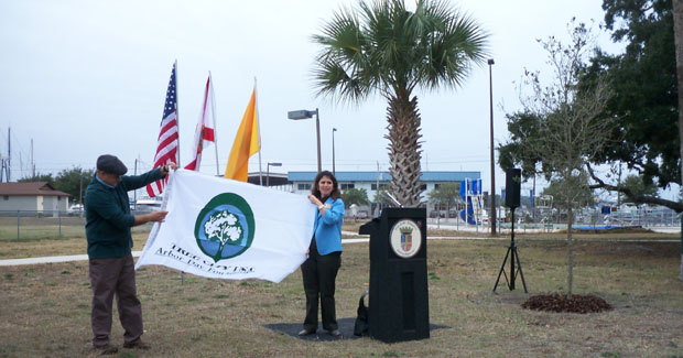
City of St. Augustine, Florida
Eddie L. Vickers Recreation Facility - Community Garden
![]()
| Street Tree Inventory Software is available from Arbor data Systems, LLC. of Florida, our Arboriculture Inventory, helps you develop a computerized Street Tree Inventory and Maintenance System. Focused toward Municipalities, Tree/Landscape Maintenance Companies, Consulting Arborists, Home Owner Associations, and Land Developers. | |||||
| Species specific database of trees/plants, with scientific name, common name, and detailed information (user enhanced), all can be configured for your area. | |||||
| Tree Inventory records each tree separately, and can be associated to a Project. It shows the location by address/GPS, general information, and pictures of the tree. | |||||
| Tree Management tracks service data, maintenance, health, and problems for each tree. Allows users to schedule regular inspections and work. Various reports are available. | |||||
For more information visit our site at
www.ArboricultureInventory.com.
|
![]()
| Arbor Data Systems, LLC. of Florida provides Street Tree Inventory Software and data collection services. The Street Tree Inventory Software was developed by Arbor Data Systems, LLC, a Software Engineer and an ISA Certified Arborist, who used their knowledge and experience to develop the system. | |||||
For more information visit our site at
www.ArborDataSystemsLLC.com.
|
![]()
![]()
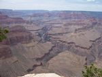

| Grand Canyon National Park, a World Heritage Site, encompasses 1,218,375 acres and lies on the Colorado Plateau in northwestern Arizona. The land is semi-arid and consists of raised plateaus and structural basins typical of the southwestern United States. Drainage systems have cut deeply through the rock, forming numerous steep-walled canyons. Forests are found at higher elevations while the lower elevations are comprised of a series of desert basins. |
Some of Our Photos: Grand Canyon
Official Website: http://www.nps.gov/grca/
| Petrified Forest National Park contains the petrified
remains of 225 million year old trees from the Late Triassic. Surrounding
the petrified wood are millions of years of deposition, uplift, and
erosion, creating the Chinle Formation. This rock formation creates the
red hues of the Painted Desert and the blue tones of the
Blue Mesa region. Petrified Forest is situated near the southern edge of the Colorado Plateau with elevations ranging from 5300 feet to 6235 feet. It was the uplift of the Colorado Plateau, starting about 60 million years ago, and the erosion that followed and continues today, which carved the present landscape. Petrified Forest National Park stretches north and south between Interstate 40 and Highway 180. |
Some of Our Photos: Petrified Forest and Painted Desert
Official Website: http://www.nps.gov/pefo/
![]()
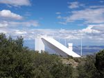
| Kitt Peak National Observatory (KPNO), part of the National Optical Astronomy Observatory (NOAO), supports the most diverse collection of astronomical observatories on Earth for nighttime optical and infrared astronomy and daytime study of the Sun. Sharing the mountaintop site with the National Solar Observatory, KPNO, founded in 1958, operates three major nighttime telescopes and hosts the facilities of consortia which operate 19 optical telescopes and two radio telescopes. Kitt Peak is located 56 miles southwest of Tucson, AZ, in the Schuk Toak District on the Tohono O'odham Nation and has a Visitor Center open daily to the public. |
Some of Our Photos: Kitt Peak National Observatory
Official Website: http://www.noao.edu/kpno/
![]()
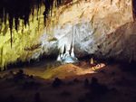
| Carlsbad Caverns National Park is located in the Guadalupe Mountains, a mountain range that runs from west Texas into southeastern New Mexico. Elevations within the park rise from 1,095 meters (3,595 feet) in the lowlands to 1,987 meters (6,520 feet) atop the escarpment. Though there are scattered woodlands in the higher elevations, the park is primarily a variety of grassland and desert shrub land habitats. Carlsbad Caverns National Park contains more than 110 limestone caves, the most famous of which is Carlsbad Cavern. Carlsbad Cavern receives more than 300,000 visitors each year and offers a rare glimpse of the underground worlds preserved under the desert above. |
Some of Our Photos: Carlsbad Caverns
Official Website: http://www.nps.gov/cave/
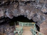
| The Ice Cave located in North Western New Mexico south of I-40 and southeast Gallup, New Mexico. The Ice Cave is Located in part of a collapsed lava tube, the Ice Caves temperature never rises above 31 F. The natural layers of perpetual ice glisten blue-green in the reflected rays of sunlight. Situated on the Continental Divide you walk through the twisted, old-growth Juniper, Fir and Ponderosa Pine trees, over the ancient lava trail to the Ice Cave. Here the natural layers of ice glisten blue-green in the reflected rays of sunlight. |
Some of Our Photos: Ice Cave
Official Website: http://www.icecaves.com/
![]()
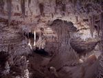
| The Caverns of Sonora is recognized as the most beautiful cave in Texas and one of the most beautiful show caves in the world. The Caverns of Sonora is located on Interstate 10, about half-way between Big Bend National Park and San Antonio Texas. They are located 15 miles southwest of Sonora, Texas and the Caverns is a great place for people of all ages to experience the wonders of nature. Along with guided tours of this beautiful cave; there are many other activities to enjoy such as gemstone panning, exploring the nature trail, enjoying a Group Tour, Specialty Tour, or one of our many Workshops, camping out in an RV or tent, or just relaxing and enjoying the outdoors. |
Some of Our Photos: Caverns of Sonora
Official Website: http://www.cavernsofsonora.com/
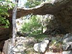
| Natural Bridge Caverns is located 30 minutes north of downtown San Antonio, eight miles west of I-35 at exit #175, Natural Bridge Caverns Road/F.M.3009. Natural Bridge Caverns is so much more than one of the most treasured natural attractions Texas has to offer. This beautiful and historical cavern system offers an experience that is high energy, educational, fun and family oriented. Whether you are a first timer, an avid caver or someone in between, Natural Bridge Caverns awaits with a once in a lifetime experience you'll never forget. |
Some of Our Photos: Natural Bridge Caverns
Official Website: http://www.naturalbridgecaverns.com/
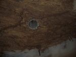
| Inner Space Cavern is located in Georgetown, Texas on the outskirts of the beautiful Texas Hill Country. The cave is convenient to IH-35 at exit 259 (Northbound or Southbound). Inner Space Cavern was discovered by a Texas Highway Department core drilling team in the Spring of 1963. While drilling through 40 feet of solid limestone, the bit broke into what is now known as Inner Space Cavern. An adventurous employee of the highway department was lowered into the hole while standing on the drill bit and holding tightly to the stem. He was the first human being to enter INNER SPACE. Hidden for 10,000 years, Inner Space Cavern is one of the best preserved caves in Texas and one of the few places where remains of prehistoric animals were unearthed. |
Some of Our Photos: Inner Space Caverns
Official Website: http://myinnerspacecavern.com/
![]()
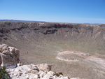
| Meteor Crater is located off I-40 at exit 233 35 miles east of Flagstaff, Arizona and 20 miles west of Winslow, Arizona. |
Some of Our Photos: Meteor Crater
Official Website: http://www.meteorcrater.com/index.php
![]()
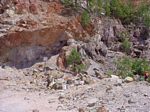
| Graves Mountain, Georgia is located about 4.5 miles south of Lincolnton, Georgia on US Highway 378 / Georgia 47 near the Lincoln County line. | |
| Organized Digs Only... | |
| GPS Lat: 33.74136, Long: -82.52142 |
Some of Our Photos: Graves Mountain
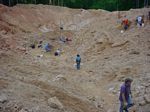
| Diamond Hill Mine, South Carolina is located south of Antreville, South Carolina near Diamond Mine Rd and Sober Rd. | |
| Organized Digs Only... | |
| GPS Lat: 34.27131, Long: -82.57505 |
Some of Our Photos: Diamond Hill Mine
![]()


| Take a trip back to a simpler time and see hundreds of pieces of antique farm equipment and tractors and demonstrations of old-time farm chores such as threshing, baling, sawmilling, cotton-ginning, syrup making and moon-shining. No admission fee. Donations appreciated. | |||||||
The 15th annual Inman Farm Heritage Days is September 16-18, 2011.
|
Ninth Annual 2005 Photos (Set A)
Ninth Annual 2005 Photos (Set B)
![]()

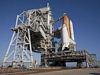
| Astronaut Hall Of Fame and Kennedy Space Center | |
| Photos available. |

STS-121 Discovery Space Shuttle Launch
| Discovery Space Shuttle Launched July 4th, 2006 at 2:38 PM from Kennedy Space Center Launch Pad 39B. | |
| Photos available. |

STS-127 Endeavour Space Shuttle Launch
| Endeavour Space Shuttle Launched July 10th, 2009 at 6:03 PM from Kennedy Space Center Launch Pad 39A. | |
| Photos available. |

STS-130 Endeavour Space Shuttle Launch
| Endeavour Space Shuttle Launched February 10th, 2010 at 4:14 AM from Kennedy Space Center Launch Pad 39A. | |
| Nighttime Shuttle Launch. | |
| Photos available. |

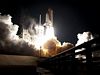
STS-131 Discovery Space Shuttle Launch
| Discovery Space Shuttle Launched April 5th, 2010 at 6:21 AM from Kennedy Space Center Launch Pad 39A. | |
| Space shuttle Discovery carried a Multi-Purpose Logistics Module filled with science racks that will be transferred to laboratories of the International Space Station. | |
| Last Nighttime Shuttle Launch. | |
| Photos available. |

| After the launch, the con-trail appeared and looked like a Nebula and later formed into Roger Rabbit. |
| Photos available. |
STS-132 Shuttle Atlantis Launch
| Atlantis Space Shuttle Launched May 14th, 2010 at 2:20 PM from Kennedy Space Center Launch Pad 39A. |
| Space shuttle Atlantis carried an integrated cargo carrier to deliver maintenance and assembly hardware including spare parts for space station systems. | |
| Photos available. |

STS-133 Shuttle Discovery Launch
| Discovery Space Shuttle Launched February 24th, 2011 at 4:55 PM from Kennedy Space Center Launch Pad 39A. |
| Space shuttle Discovery carried the Express Logistics Carrier 4 (ELC4), a Multi-Purpose Logistics Module (MLPM) and critical spare components to the International Space Station. | |
| Photos available. |

STS-134 Shuttle Endeavour Launch
| Endeavour Space Shuttle Launched May 16th, 2011 at 8:56 AM from Kennedy Space Center Launch Pad 39A. |
| Space shuttle Endeavour will deliver an EXPRESS Logistics Carrier-3 (ELC-3) and an Alpha Magnetic Spectrometer (AMS) to the International Space Station for a 16 day mission. | |
| Photos available. |

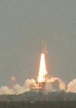
STS-135 Shuttle Atlantis Launch Final Shuttle Mission
| Atlantis Space Shuttle Launched July 8th, 2011 at 11:26 AM from Kennedy Space Center Launch Pad 39A. |
| Space shuttle Atlantis will deliver the Raffaello multipurpose logistics module to deliver supplies, logistics and spare parts to the International Space Station. Atlantis also will fly a system to investigate the potential for robotically refueling existing spacecraft and return a failed ammonia pump module. | |
| Photos available. |
Note: Want the code for the Slideshow? Just email rClark@ScratchPadWebsite.com
![]()
Note: These desktop images have been formatted for the primary screen resolutions. Just click on the link for the size desired, then right-click on the image and Set as Background. If we have another image that you would like for a desktop image, just email us and we will send you our full-size image, just provide the image name (right-click and Properties). Send Emails To: rClark@ScratchPadWebsite.com
|
Petrified Wood |
|||
|
|
|
|
|
|
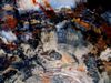
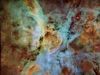
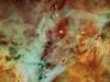
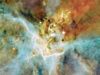
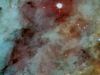
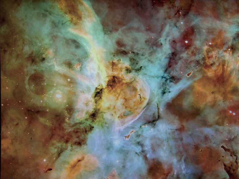
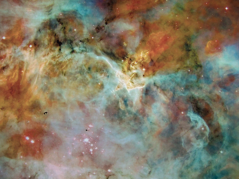
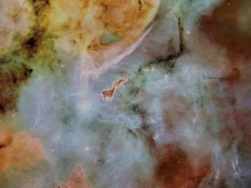
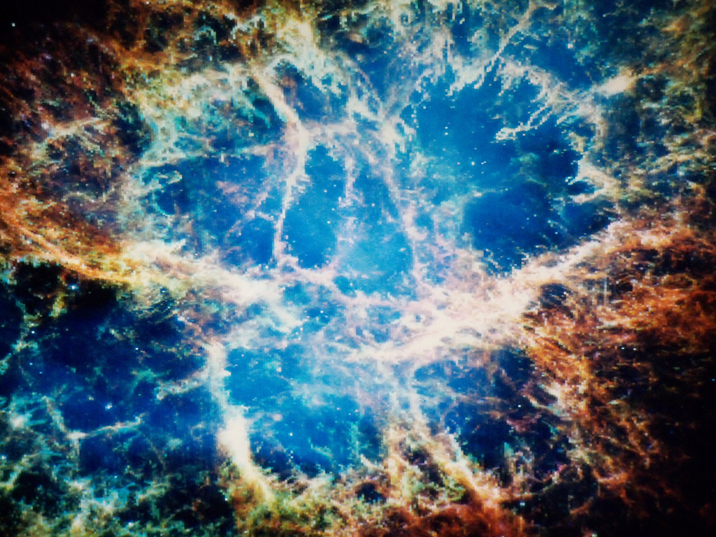
Nebulae (From NASA/Hubble Pictures) |
|||
|
|
|
||
|
|
|
||
|
|
|
||
|
|
|
||
|
|
|
||
|
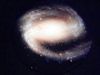
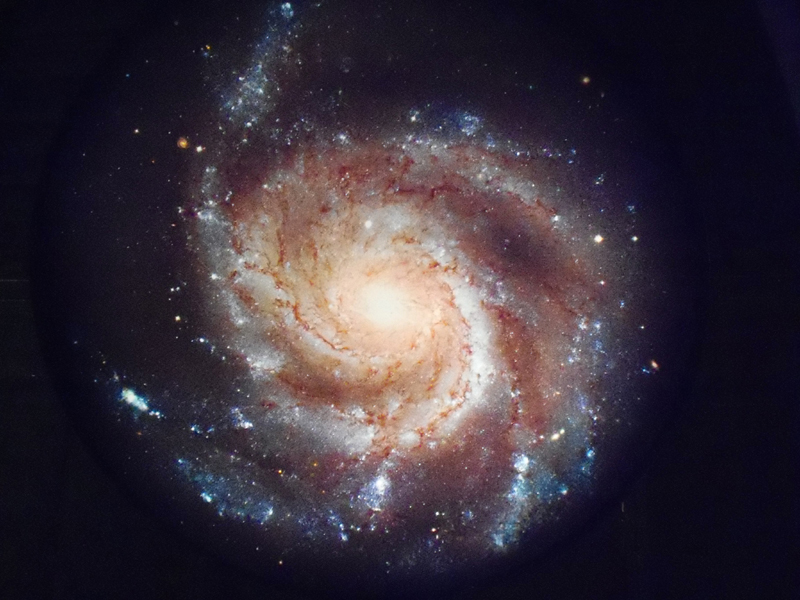
Galaxies (From NASA/Hubble Pictures) |
|||
|
|
|
||
|
STS-130 (NASA Pictures) |
|||
|
|
|
||


![]()

Color Charts (RGB, Names, Netscape)
| Color Table Selection | Description |
| RGB Color Table |
RGB Color Table |
| Named Color Tables | Colors are arranged by Shade |
| Named Colors Alphabetical | Colors are arranged Alphabetically |
| Netscape Named Colors | Netscape Defined Colors |
![]()
email: rclark@scratchpadwebsite.com
Last Update: 07/05/2014 08:37:35 -0400