Mapping Errors
We all know that no mapping system exists that is correct in all areas. The correct position was located using Google Maps and based on the aerial photos. Shown is the common position of most mapping systems. The address we were looking at was 110 Dylans Ct., Covington, GA 30014, located at Lat-Long 33.53357, -83.84741. This just happened to be the first place I click on from the FieldRepPro program, other addresses in the area were also correct.
FieldRepPro uses Area Entry Locations and Major Intersections to help fight these problems with mapping errors. FieldRepPro uses up to two Area Entry Locations which have up to three Major Intersections associated to them. FieldRepPro uses MapPoint at least gets you close if not on the mark, then you can view in Google and center the correct location and retrieve the Latitude and Longitude for that location with a simple script.
Microsoft MapPoint 2010 and Microsoft Streets & Trips 2009 and 2010 (Wrong)
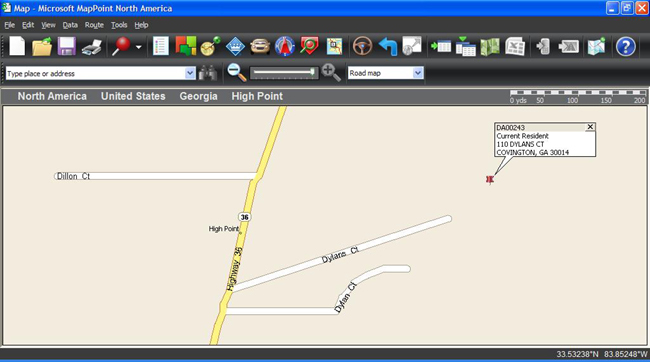
All three roads are incorrect. Dylan Ct. (lower right) and Dillon Ct. (Left) are private driveways. Dylans Ct. should begin across the street from from where Dillon Ct connects to Highway 36.
Bing Maps (Wrong)
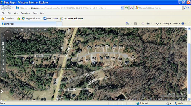
All three roads are incorrect. Dylan Ct. (lower right) and Dillon Ct. (Left) are private driveways. Dylans Ct. should begin across the street from from where Dillon Ct connects to Highway 36.
Google Maps (Correct)
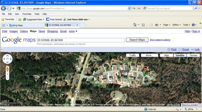
This is correct, but other errors exist further north and south for those who know the area.
Google Earth (Correct)
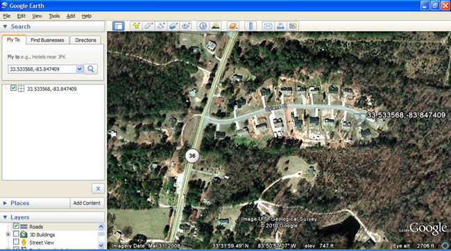
This is correct, but other errors exist further north and south for those who know the area.
DeLorme Earthmate GPS (Bad Wrong)
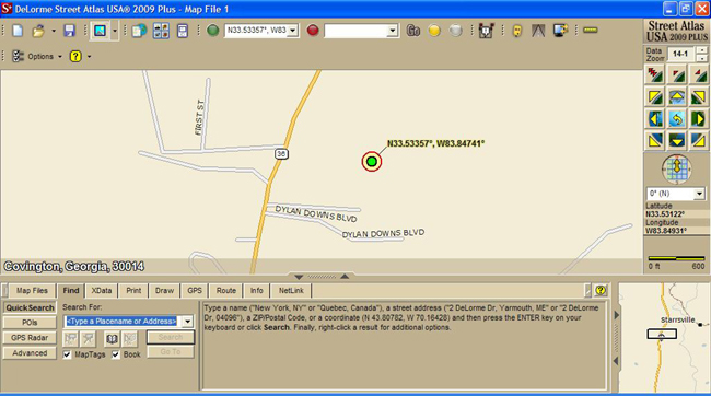
This one really missed the boat. Dylan Downs Blvd??? But at least you can correct the problem with the ability to add roads. This is a real plus for areas under development.
MapQuest (Wrong)
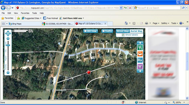
All three roads are incorrect. Dylan Ct. (lower right) and Dillon Ct. (Left) are private driveways. Dylans Ct. should begin across the street from from where Dillon Ct connects to Highway 36.
Yahoo Maps (Wrong)
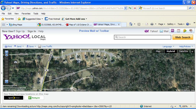
All three roads are incorrect. Dylan Ct. (lower right) and Dillon Ct. (Left) are private driveways. Dylans Ct. should begin across the street from from where Dillon Ct connects to Highway 36.
OpenStreetMap.org (Real Close)
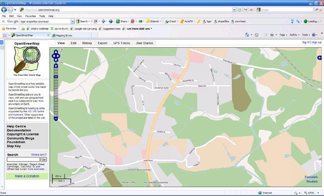
This one looks real close to how it is, at least it will get you there.
MapWindow GIS with US-Census TIGER shapefiles (Correct)
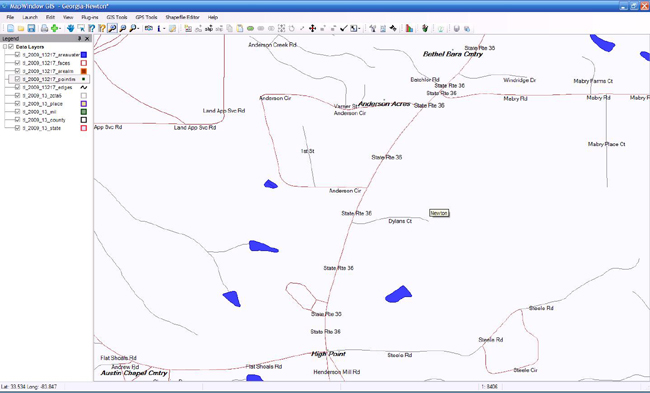
This is all correct and so are some of the other areas that are bad wrong or missing. But the shapefiles contain allot more geographic features.
Note: MapWindow GIS is a free desktop geographic information system (GIS) application with an extensible plug-in architecture. This application does not provide any turn by turn directions, just good mapping.
Mapping Error Comparisons
-
Google Maps and Google Earth - Best Results
-
Both were correct since they use the same data.
-
Some other area roads were marked, but with no name, these were private driveways.
-
-
Microsoft Streets & Trips, Microsoft MapPoint, Yahoo Maps, and MapQuest
-
This is the most common wrong position of the roads.
-
-
DeLorme Earthmate GPS - Worst Results, But Correctable!!!
-
Indicated roads as Dylan Downs Blvd.
-
The other roads on the do not appear to be in the correct position.
-
But you can use the drawing tools to correct the problems.
-
-
MapWindow GIS
-
Mapping depends on the shapefiles being used. Some counties provide even more updated shapefiles. Our shapefiles are from US-Census TIGER which are currently being updated.
-
This application does not provide any turn by turn directions, it is just a GIS.
-